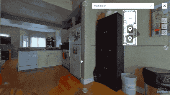
What Are You Looking At?
Well, now you can tell! We’ve been stealthily rolling out updates over the past few weeks, one of the bigger ones involves a much-requested feature to both our Maps and GeoTag Maps (Google Maps) integration:
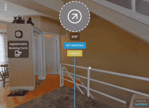
Dynamic Animated View Indicators, Dude.
Radars, View Indicators, D.A.V.I.D., whatever you call them, you’ve now got them! Now your users can get a visual indicator of where, and in what direction, they’re looking in.
Things flow both ways with our indicators. Users can “grab” the indicator, and move it around. The main view and all other related indicators are updated automatically. This works with both mouse and touch-based devices, naturally.
What’s Up, Where’s Up?
These new view indicators work by using any embedded Heading data in your images EXIF data, or by selecting where “North”, (or whatever you’re using for “up”), is in your Snaps. Once you’ve set your Heading, the view indicators will automatically appear where applicable.
Check out the Details area in your Snap Preferences to find the Heading setting.
What about the Real World™?
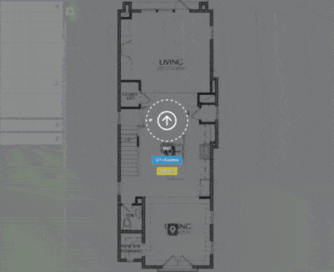
What if your floor plan doesn’t line up with the actual North? Simply tell SeekBeak where North is on your uploaded Maps, and watch as the view indicators sync up your Map as well as the GeoTag map view simultaneously!
The Map Heading setting is conveniently located in the Details area in the Map Preferences.