GPS, Geo Tag and Mapping Solutions for 360 Photos
Automatic GPS Coordinate Mapping for Your 360 Photos
SeekBeak reads the GPS data encoded in the EXIF data embedded in your image, and depending on your preferences, can use that latitude / longitude information to plot out the location on our integrated Google Mapping solution.
Snap Preferences -> Properties
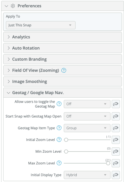
You can find the relevant Geotag / Google Map settings in the Properties menu.
Geotag Navigation
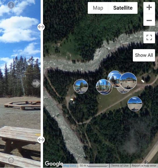
Opening up the map reveals a draggable slider, and thumbnails of your Snaps placed at their correct locations in the Map on the right!
Slide-out Maps
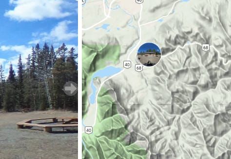
Once you enable the Geotag map, a new "Globe" icon will appear on the right side of your Snap.
Depending on how you set it up, you can show all Snaps in a Group, or Snaps only linked by Hotspots, for virtual tours which span multiple Groups. There are plenty of other customization options depending on your needs.
Good 'ol Google
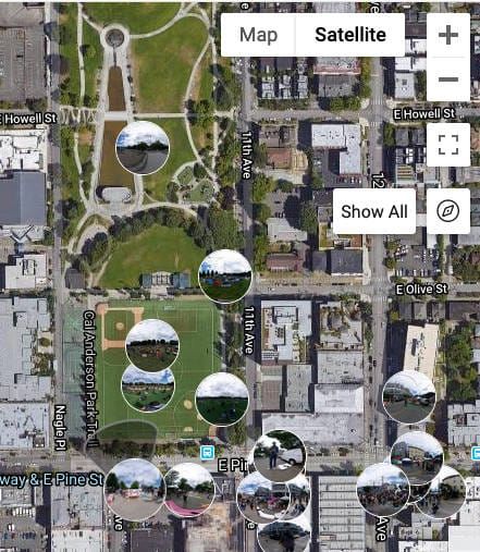
As we're using Google for the maps, your users automatically get all the features available with Google Maps, including terrain view, satellite view, hybrid maps, as well as different perspectives depending on zoom level.
We've even put in a handy "Show All" button which will automatically zoom and pan the map to show all your Snaps.
Manually update GPS Data
Some of you may be asking: "But what if my camera doesn't have any new-fangled GPS system?".
Fear not, we've got you covered: There are a couple of Latitude / Longitude text boxes in Properties under the Details header where you can manually enter the information!
One of the easiest ways to find the proper coordinates is to simply find the location in Google Maps, then copy the lat/long coordinates into SeekBeak.
For more details on how to manually enter the GPS coordinates, check out our how-to blog post here: Adding GPS Coordinates to your SeekBeak Tour
#Protip: When you are in Edit mode, drag handles will appear next to each of your Snap thumbnails... just Drag 'n Drop your images, and SeekBeak will update their real-world coordinates behind the scenes!